Welcome to the Garfield County property viewer application. Please use the site feedback link in the upper right to contact the GIS department staff with questions, comments, or suggestions.
DISCLAIMER: This viewer is not a substitute for official government records maintained by the Planning Department, the County Clerk and Recorders Office, the Assessor's Office, or for any legal description information in the chain of title. I Garfield County makes no warranty as to the accuracy or suitability of any information contained herein for any other purposes. The user shall assume all risk and responsibility for any and all damages, including consequential damages, which may propagate from the user's application of this information.
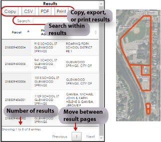
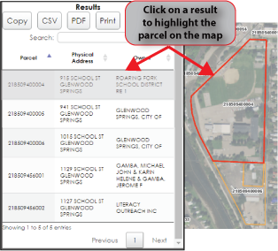
Search
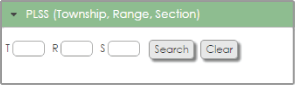
PLSS (Township, Range, Section)
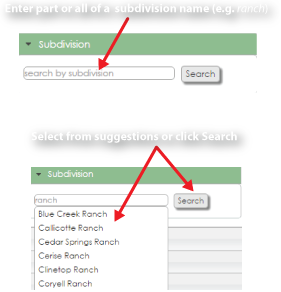
Subdivision
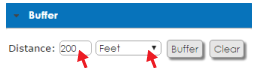
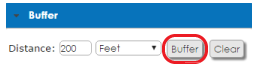
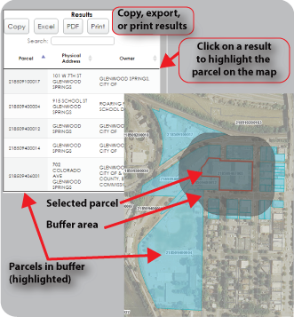
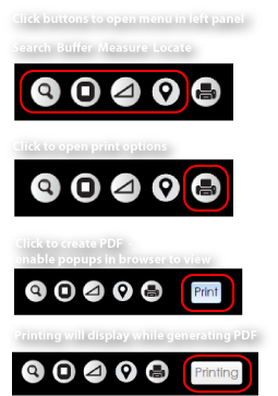
Buffer
1.Set distance and units
2.Click Buffer button
3.Click parcel on map to buffer
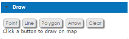
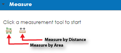
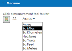
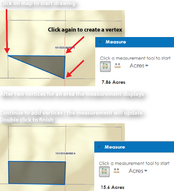
Draw
Click a button to draw on map